Background
Since September 11, 2021, a swarm of siesmic activity had benn ongoing in the southern flank of the Spanish Canary Island of La Palma (Cumbre Vieja region). The area was under surveillance after more than 22,000 tremors were reported in one week. The increasing frequency, magnitude and shallownes of the events were an indication of a pending volcanic eruption, which eventually occurred on September 19 at 15:15 hours (UTC), leading to evacuation of people in the vicinity.
Being Spain part of the Europen Union, the Copernicus Emergency Management Service was activated on that same day of September 19 at 19:08. This service uses satellite imagery and other geospatial data to provide free of charge mapping service in cases of natural disasters, human-made emergency situations and humanitarian crises throughout the world.
The maps below just pretend to be complementary to those of Copernicus, and seeking to be helpful for authorities in the Government of the Canary Islands, and more specifically, in La Palma.
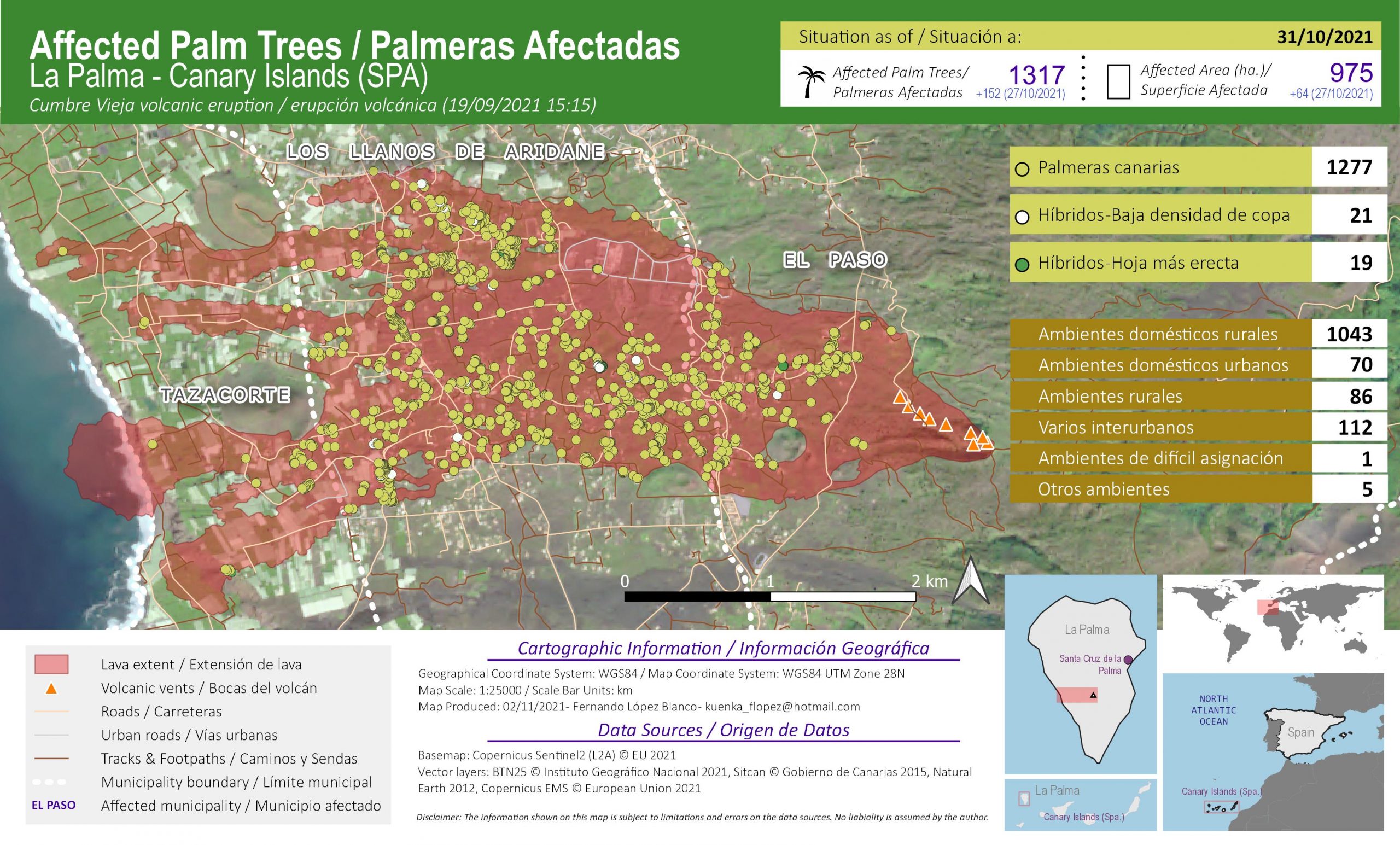
Palm Trees Affected by Lava
These series of maps show the palm trees covered by lava since the start of the eruption. It is noted on each map, apart from the grand total, the figures for each type of palm tree, as well as the environment where the tree stands. For completeness, the total surface of the lava flow is also given for comparison purposes.
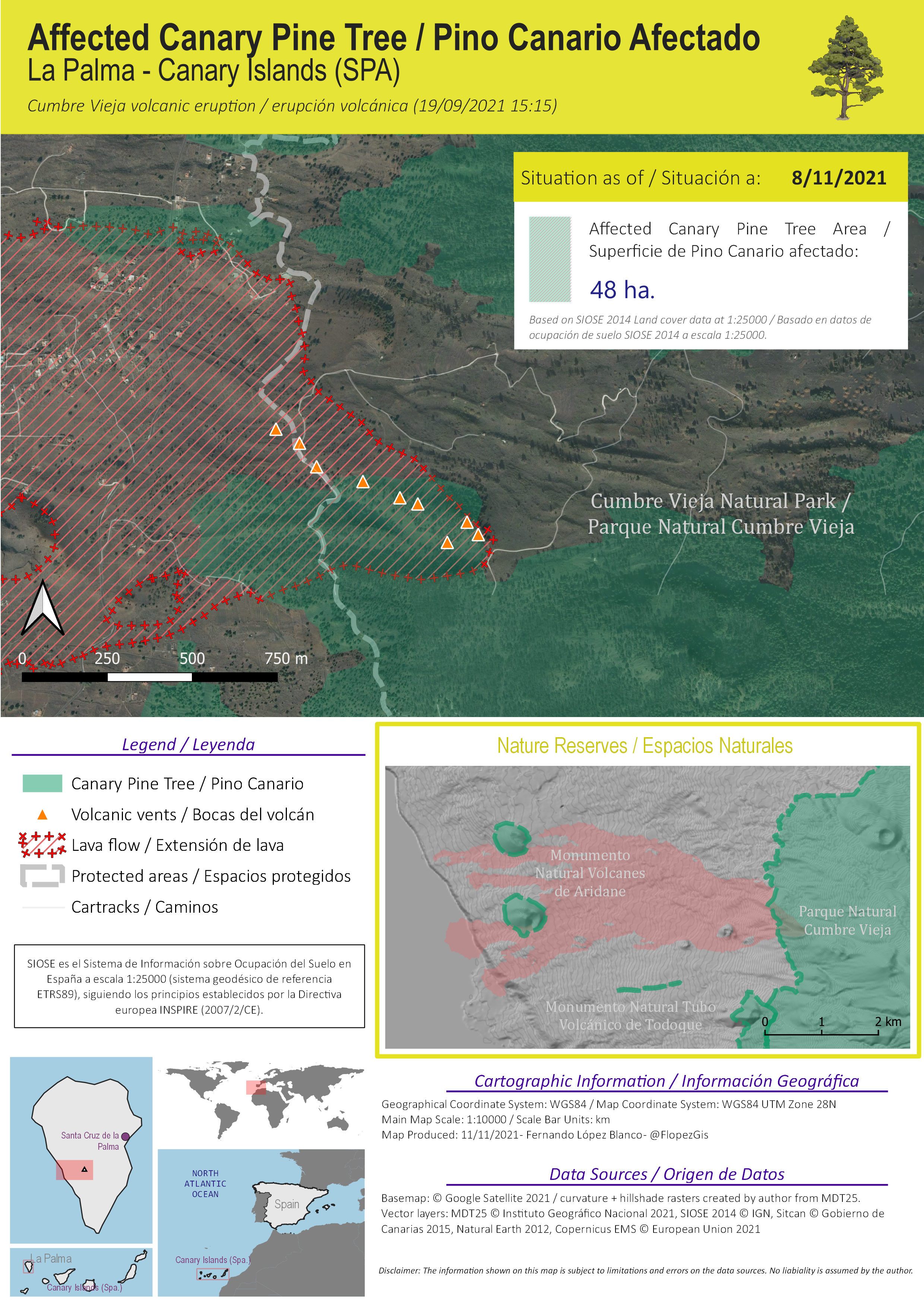
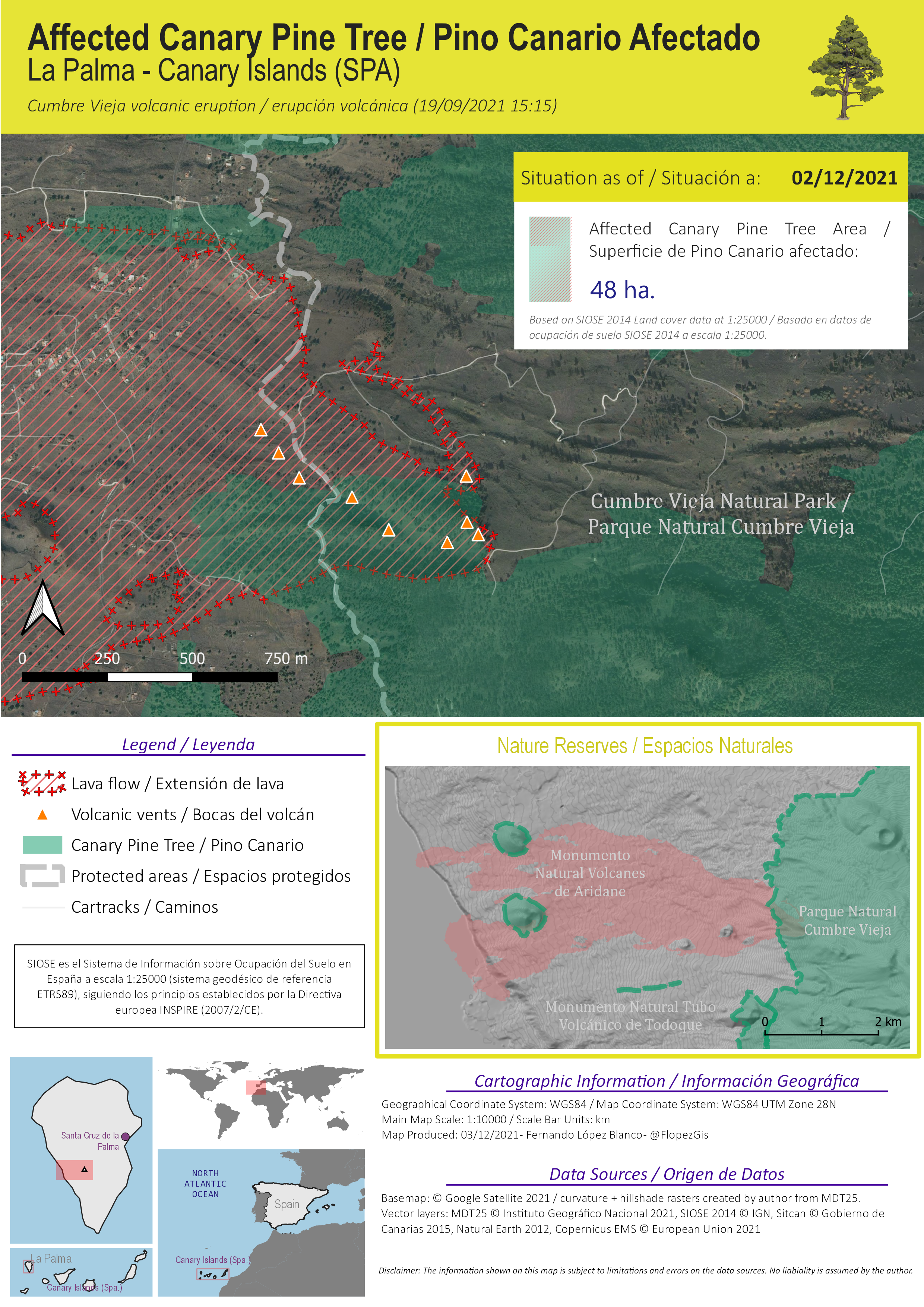
Canary Pine Trees Affected by Lava
These series of maps show the Canary Pine trees covered by lava since the start of the eruption. They are based on SIOSE 2014 (IGN, Spain) Land Cover data at 1:25000. The figure given on every map is the number of hectares affected, all nearby the vents, where the forests occupy the high-altitude grounds of La Palma.
Pine Woodlands with Termophile Scrub Affected by Lava
These series of maps show the pine woodlands covered by lava since the start of the eruption. They are based on Agrupaciones Forestales de la Palma data at 1:25000 by Gobierno de Canarias. The figure given on every map is the number of hectares affected, all nearby the vents, where the forests occupy the high-altitude grounds of La Palma.
