GIS Specialization – Capstone Project
University of California, Davies (Coursera)
Background
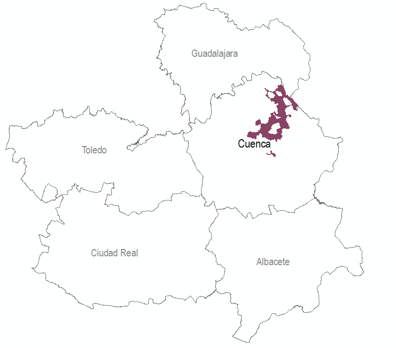
The purpose of this project (Feb-Apr 2020) was to quantify and to map the amount of carbon sequestration by forest biomass in the Municipality of Cuenca, one of the largest townships in Spain and second in Europe in terms of forestry cover. Specifically, the project sought to answer a twofold question: what is the evolution of vegetation carbon sink and stock over time and what are the most interesting areas in terms of economic value for carbon trading.
1. Data Acquisition & Management
The two main datasets used for the project were the Second Spanish Forestry Inventory 1996 (SFI2) and the Third Spanish Forestry Inventory 2007 (SFI3), publicly available. They come in different formats so the process of data consolidation for Cuenca municipality was different and mostly manual.
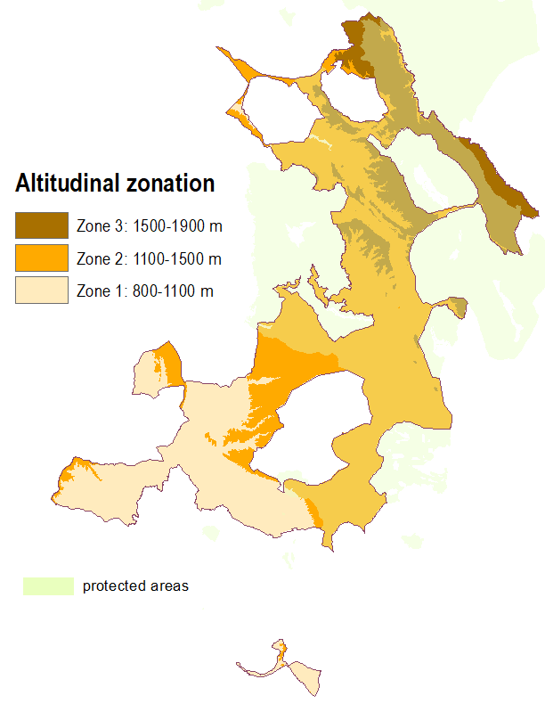
A DEM was also created for the study area by mosaicking the 25-m contour matrix files from LIDAR data. This DEM was reclassified into 3 altitudinal intervals to check economic variability per sector.
Coordinate system used throughout was ETRS 1989 UTM Zone 30N.
2. Material Amount Estimates
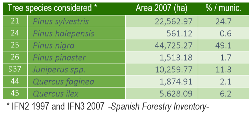
The goal for this step is to get Vegetation Carbon Stock and Carbon Sink estimates (in metric tons and metric tons per hectare) for each of the 7 major tree species considered after the previous data consolidation. Both above-ground biomass (stem, branches and foliage) and under-ground biomass (roots) were considered, along with Spain-specific coefficients and models to get total biomass amounts.
From those biomass estimates, both VCSi and VCSt amounts can be worked out by using Net Primary Productivity equations and Carbon Fraction coefficients, respectively.
3. Valuation & Mapping
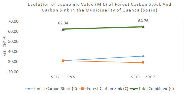
Based on the previous outputs and on the price of Carbon tax for Spain as of the time of this project (15 €/t CO2), economic values per hectare were obtained for every tree species considered.
Finally, the different features were summed and presented as 25-m cell-size rasters to match the resolution of the DEM. The two final rasters (one per Forest Inventory) were then reclassified into 4 natural breaks (Jenks) to show ~10 € intervals. Both a print map and a web map were created.
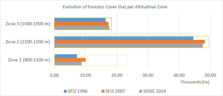
An additional by-product was obtained by comparing the total forest cover surfaces against the altitudinal zones. For this purpose, an additional inventory was gathered and processed to get a closer reference in time, for unfortunately the Fourth Spanish Forestry Inventory was not finished for the province of Cuenca as of April 2020.
The mentioned inventory was SIOSE 2014, which is a Spanish Land Use and Land Cover Inventory at a 1:25000 scale. Categories 31x (coniferous, broadleaved, and mixed forests) and 340 (mixed vegetation), with a canopy cover fraction greater than 10%, were selected to get forest cover surfaces.
Sources
Ministerio de Agricultura y Medio Ambiente (Spain), Instituto Geográfico Nacional (Spain), Agencia Estatal de Meteorología (Spain).